


- Details
Dwa lata trwało odbudowanie zaplecza komunalnego Szklarskiej Poręby. Poprzez doprowadzenie do bankructwa i likwidacji „Estetyki” (ZEiOM) miasto w 2006 roku straciło mnóstwo sprzętu potrzebnego do prowadzenia napraw i remontów.
- Details
- Details
- Polska Gazeta Wrocławska z 7 maja 2010 "Przejdź nowym szlakiem" - artykuł o otwarciu Szlaku Walońskiego w Szklarskiej Porębie
- Miesięcznik Jablonecki, czerwiec 2010 - Ve Sklářské Porebě vyznačili unikátní stezku - artykuł o otwarciu Szlaku Walońskiego w Szklarskiej Porębie
- La "Piste wallonne " à Szklarska Poręba dans les monts Karkonosze - 11 maja 2010 - informacja o otwarciu Szlaku Walońskiego na stronie internetowej Wspólnoty Walonia-Bruksela
- MOSTY marzec 2010 "Odbudowa kładki dla pieszych w 3 miesiące"
- Gazeta Wyborcza / Turystyka z 5 - 6 grudnia 2009
- Gazeta Wyborcza / Turystyka z 28 -29 listopada 2009
- Gazeta Wyborcza / Turystyka z 18 listopada 2009
- Nowiny Jeleniogórskie nr 22 z 2 czerwca 2009
"Chrzciny ponad Szklarską. Józef Gołba dopiął swego - wybudował schronisko na Wysokim Kamieniu"
- Polska Gazeta Wrocławska z 29 maja 2009 "Precz z nudą! Nareszcie będzie można poszaleć"
- Polska Gazeta Wrocławska z 19 maja 2009 "Szklarska Poręba już jutro chce powalczyć o puchar"
- Polska Gazeta Wrocławska z 11 maja 2009 "Wkrótce pojedziemy koleją do Jakuszyc i Harrachova"
- Nowiny Jeleniogórskie nr 18 z 5 maja 2009 " Śnieżna Majówka - pożegnanie z biegówkami"
- Nowiny Jeleniogórskie nr 13 z 31 marca 2009 "Na wszystko zgadzać się nie będę - rozmowa z Justyną Kowalczyk"
- Jelonka z 30 marca 2009 "Justyna Kowalczyk twarzą Szklarskiej Poręby?"
- Gazeta Wyborcza z 25 marca 2009 "Kowalczyk w Jakuszycach"
- Voyage nr 12(125) grudzień 2008
- Nowiny Jeleniogórskie nr 44 z 28 października 2008 "Rzeźbione głazy w szklarskiej, magicznej"
- Gorlitzer nachrichten z 1 grudnia 2008
- Details
The
trip starts by the Tourist Information Office. We walk through the
town centre past Skwer Radiowej Trójki [Radio
Three Square]. Next we enter the green
trail, parallel to Kamienna River and Motorway No. 3. We pass by
Czerwona Jama [The Red Cave]. On
the left a campsite called “Baza Pod Ponurą Małpą [Base
at Gloomy Monkey] can be seen – the
legendary place where, for over 40 years, the National Students’
Song Contest has been held. We walk down towards the entrance to
Szklarka Waterfall – a picturesque waterfall with a hospitable
hostel “Kochanówka” next to it. On the way back we can visit the
place where Jan Sztaudynger, Polish famous author of epigrams used to
live and write his outstanding short, satirical poems.
Trip time –
about 2 hours.
- Details
The
route in its most part is not marked. The trip starts by the Tourist
Information Office. We walk along the blue trail which
offers outstanding landscape views. We go past Dinopark, three
interesting Catholic churches in Szklarska Poręba Górna [Upper]
and Dolna [Lower],
we can visit the house of Gerhart and Carl Hauptmann (currently the
seat of The Karkonoskie Museum) and also the house of Wlastimil
Hofman, an outstanding painter in the period of Młoda Polska, who
used to live in Szklarska Poręba for the last 23 years of his life.
Szklarska Poręba Dolna represents the oldest part of the town.
Trip
time – about 3,5 hours.
- Details
The
trip starts by the Tourist Information Office. We walk through the
town centre along the green trail until we reach the black trail at
Kołłątaja Street where Glass Factory in the Woods is situated. At
the car park in front of the factory there is a giant sculpture of
the Ghost of the Mountains and his Lady. Glass Factory in the Woods
is the place where glass manufacturing traditions have been preserved
for centuries and make Szklarska Poręba a famous place. Visitors can
witness hand made glass production and buy glassware in the factory
outlet. After leaving the Glass Factory in the Woods we walk along
the road towards Old Walloon Hut which used to be the seat of the
Walloons, legendary mineral stones diggers and excavators. There we
can learn about treasuries to be found in The Karkonosze and The
Izery Mountains. The black trail takes us back to the centre of
Szklarska Poręba.
Trip
time depends on the time spent in the Glass Factory in the Woods and
Old Walloon Hut.
- Details
The
trip starts by the Tourist Information Office. A cobbled road takes
us up in the direction of Świeradów. Behind a pass-over we turn
left and follow a red trail. On the left, just above the railway
station in Szklarska Poręba Górna there
are Białe Skałki – an excellent view point over The Karkonosze
Mountains. We have to change the red trail into the black one when we
get to Rozdroże [The Crossroads]
at the foot of Wysoki Kamień [The High
Stone]. We turn right and walk along
Droga Sudecka [Sudeten Road].
It is not a tourist trail, but just a road closed for traffic. It
leads us till the end of black trail until we reach Zakręt Śmierci[The Death Curve]. There
is a wonderful view point (with an installed telescope) providing an
outstanding panorama of The Karkonosze Mountains.
Trip time – about
90 min.
- Details
The
trip starts by the local Tourist Information Office and goes along
Jedności Narodowej Street to Skwer Radiowej Trójki [Radio
Three Square]. In the middle of the
square there is a sculpture of The Ghost of The Mountains – The
Ruler of The Karkonosze. Having obtained the Ghost’s permission to
continue the trip we can move along 1 Maja Street passing by the town
centre. Heading towards the chair lift to The Szrenica Mountain it is
worth to stop by the Stone Circle which idea provider and author is
Mr Zbigniew Frączkiewicz, the local artist. Moving further along
Kilińskiego Street we can visit The Mineralogical Museum where
minerals from all over the world, different fossils, a dinosaur’s
skeleton and a fragment of Carboniferous wood have been provided for
visitors. Next we go past Marianki Rocks and The Karkonoskie Centre
of Ecological Education. It is a modern, interactive and multimedia
centre where a lot of interesting curiosities may be learned about
The Karkonosze Mountains. Next we have to follow the black trail
which leads us to Rozdroże [The
Crossroads] at the foot of Kamieńczyk.
We have to change the trail to a red one which takes us straight to
Kamieńczyk Waterfalls. Its gorge can be entered only in protective
head helmets! There is a hostel by the waterfalls where a snack may
be enjoyed. On the way back we take the red trail, go past the
crossroads at the foot of Kamieńczyk and keep following the red
trail till we reach the car park by Czeska Szosa and take the
direction towards Krucze Skały by which the Mountain School QUASAR,
specializing in mountain climbing, is situated. The trip ends in the
point where it started, i.e. by the Tourist Information Office.
Trip
time (excluding time spent in museums) about 2 hours.

- Details
Karkonosze are
covered with the
densest network
of hiking
trails in
all of Sudetes.
There
are several
hundred kilometers of them,
not
counting
bike
paths and
ski trails.
The
trails in the Jizera Mountains intersect the
most interesting
regions,
leading primarily to
the major
attractions.
Hiking trails marks
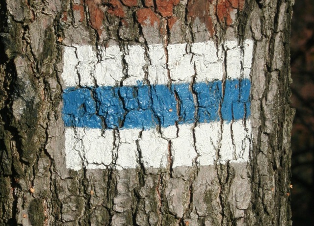
The basic sign marking tourist trails is usually a rectangular sign measuring 15x9cm, painted with oil paint in visible points. It consists of three horizontal stripes: two white outer stripes and the middle one in the color of the trail. Depending on the color of the middle stripe, we may encounter the following routes: 1) red, 2) blue, 3) green, 4) yellow; 5) black.
NOTE:
The color does
not describe
its
difficulty
or
length.
It
is assumed that
the red sign
marks the main trail, whereas
black marks the so-called connecting trails.
![]() mark the
beginning (end) pathway, indicates that at
this point
a trail
begins (or ends)
mark the
beginning (end) pathway, indicates that at
this point
a trail
begins (or ends)
![]() basic character, indicates
that you
should go straight
basic character, indicates
that you
should go straight
![]() turning mark, indicates that you
should
turn after
passing the sign, in
the indicated direction
turning mark, indicates that you
should
turn after
passing the sign, in
the indicated direction
![]() turning mark, indicates that
you should
turn before
passing the sign
turning mark, indicates that
you should
turn before
passing the sign
- Details
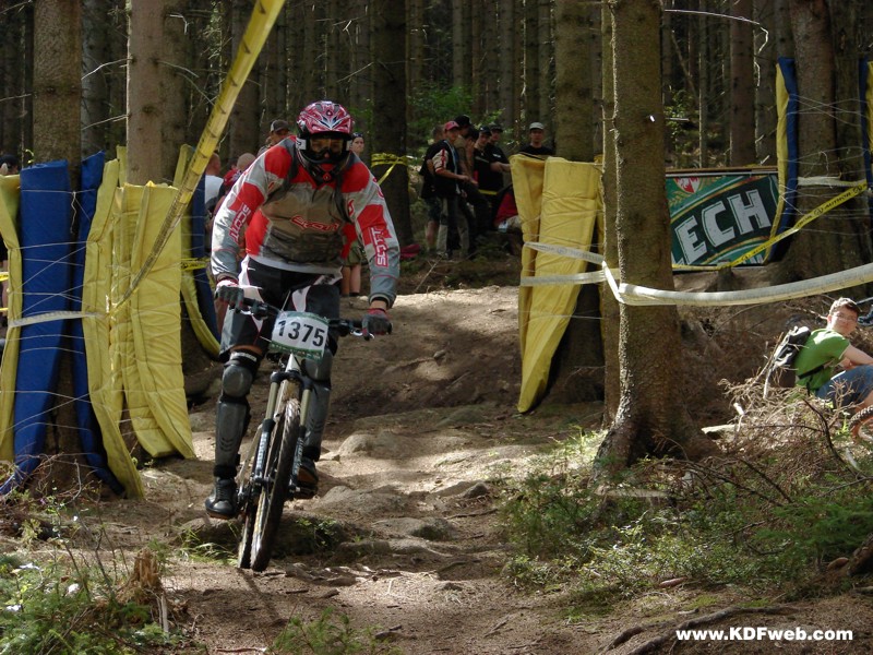
In the early 1990's the first bike marathons in Poland were organized in Szklarska Poreba. The growing interest in the competition meant gaverise to accompanying events. After several years, the informal meetings of MTB cyclists turned into the Bike Festival, which continuously takes place in mid-August. The area under the lower cableway station on Szrenica turns into a bicycle town for several days. Still, the most important event is the cycling marathon with the famous, grueling driveway to the Petrowka. But enthusiasts of downhill cycling and acrobatics do come to Szklarska Poreba as well. There is no shortage of BMX performances, and the event is accompanied by the largest bicycle trade fair in Poland. Dozens of exhibitors presenting what is the latest novelty in bicycles. You can buy everything that is necessary for all kinds of cycling sports, from extreme downhill to ordinary equipment for a tourist-cyclist. The event is accompanied by a video review of cycling.
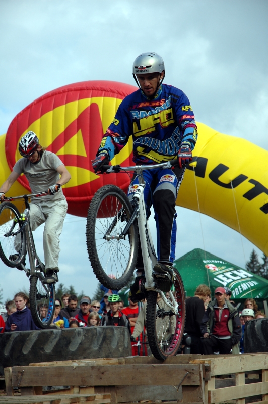
The final event is Sunday's diving competition. The length of the jump is not important however; the brilliance is. The judges decide who wins, and the audience applauds the rewarded cyclists-jumpers.
Bike Festival in Szklarska Poreba is the only such event in Poland, during which not only victory counts, but primarily being involved in a sporting and social event.
More information about the festival can be found on the organizer's website and the websites www.bikeaction.pl and www.festiwalrowerowy.pl.
![]() see film
see film
- Details
You can find:
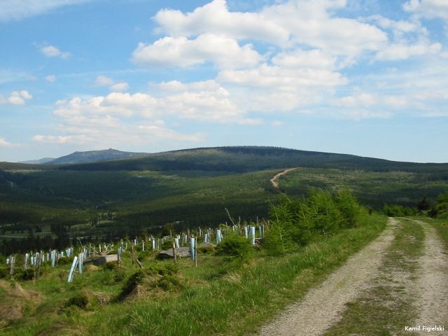
- The easy trails, small clearances, magnificent panoramas, large spaces in the Jizera Mountains
- In the Karkonosze - advanced routes and at the same breathtaking scenery
- Contact with nature - 80% of the routes run along forest paths, gravel and pebble trails, or mountain paths in the immediate vicinity of the Karkonosze National Park
- The possibility of all-day-long trips by bike or on foot, visiting the hospitable hostel accommodation with mountain food along the way
- Accommodations in the year-round guest camping or private pensions, houses or hotels
- "Accommodation for bicycles" - the homes on the premises with the closed parking for bikes
- Bike rentals, service stations and hardware stores and bike accessories
- Central Europe's largest Festival of Cycling BIKE ACTION - marathon, downhill cup, dirt jump, trial show www.bikeaction.pl
Cycling routes in figures

- 19 marked cycling routes
- 450 km - total length of paths for cyclists
- 8 km - the longest downhill on the route,
- 1150 m above sea-level- the highest point on the route
- 1 to 5 scale of difficulty of slopes
- Length of the route from 8 to 50 km
Marking of bicycle routes
Look out for signs painted on trees, rocks, walls or free-standing slabs. you can find items on the white background:
- Biker silhouette
- The number or numbers of routes
- Arrows
- Sponsors logos
- Warning signs - exclamation points (from one to three) indicate the need for extreme caution
- As part of marking routes are free-standing, large-scale maps of cycling routes included in the nodal points, to facilitate orientation and movement on the area.
Hardware requirements and rules for the routes use
Most routes in Szklarska Poreba go along forest roads (mostly gravel roads) and stony, mountain paths, so they need to be covered on a mountain bike, whose greatest strength has to be technical efficiency (propulsion system and brakes!) and checked parameters. Your safety depends on the condition of your equipment! Helmets are recommended, as well as goggles, gloves, and pads, especially on routes with the highest degree of difficulty.
The most important principle of the use of bicycle routes:
- navigate the marked routes
- compliance with traffic bans
- unconditional compliance with safety rules - your own and of other users
- giving way to hikers
- respecting the nature principles
- objective assessment of your own capabilities - equipment and fitness
- appropriate clothing and equipment (including food)
Description of Cycling Routes
- Route 1 Szklarska Small Loop (Mała
Szklarska Pętla)
The route length of 13 km, starts in the city center and runs through the streets near the stadium, the Church of St Corpus Christi. On the way visit the Museum in Szklarska Poreba, then Wlastimil Hofman's House in Lower Szklarska Poreba, The Wobbling Stone, back thought the Dolna street, Armii Krajowej street and Podgórze settlement to the White Valley (Biała Dolina) and to the city center.
- Route 2 Cogeneration Route
The route is 50 km long, runs to the Polish Jizera Mountains and Czech Karkonosze. It is a difficult route, at some points there are sharp climbs and hard gravel surface. Very interesting route, combined with the Czech cycling route No. 2, so you should bring your passport. You can visit the surroundings of Harrachov - city center and waterfall Mumlava, on the Czech side. Take a moment to watch the famous mammoth ski jump. Start your trip in the heart of Szklarska Poreba, so you go to the holiday village "South Slope" ("Południowy Stok"), where there is a Spring of Health and Love, stay there for a while and enjoy the wonderful properties of spring water. You should look at Karkonosze through a tourist telescope. Then we head towards the Jizera Mountains, thought quartz mine "Stanislaw" (now closed, the highest in Europe, open pit mine), to the highway in the direction of Jakuszyce. We cross the state border by a road crossing in Jakuszyce, and after visiting the area Harrachov back to Szklarska Poreba.
- Route 3 Radio Trójka Route
The route can be described as Big Szklarska Loop, as it goes around the city, allowing you to visit many interesting places. However, this is a difficult route, as it requires good equipment and considerable skills. Less trained cyclists will be required lead their bikes on some sections. Route length of 20 km. Start at the Radio Trójka Square, this leads in turn - through the center, next to the Old Cottage Wallon - note here! You must step in to meet Master Walloon, who can clean you from all filth. His good advice will be useful in further trips; if you're lucky, you may be able to find the treasure of Walloons. Next pass to the Szklarka waterfall and then go through Lower Szklarska Poreba to the Death Turn. Then go from The Death Turn to the White Valley, thence to the Kamieńczyk Crossroads to the bottom lift station and back to Szrenica on Radio Trójka Square.
- Route 4 Three Districts Connector
This is one of the easier routes - you can warm up. It is 9 km long and runs along most of the areas in Lower Szklarska Poreba. Beginning in the center of Upper Szklarska Poreba - next to the Tourist Information. Go to Lower Szkarska next to the Church of Corpus Christi, then the next CRR KRUS, sharp downhill ride via Waryńskiego street. Back through Armii Krajowej Street.
- Route No. 5 Karkonosze
Express under Floors
Quite an easy route, with a length of 19 km. Very nice scenic, beginning in downtown, highway access to the Kamieńczyk parking lot, next though forest roads in the foothills of the Karkonosze to Way Under Floors, hence Kasprowicz street back to the center.
- Route No. 6 Three Sycamores Loop
Route in the vicinity of Michałowice, fairly easy, with a length of 8 km. Start and end at the crossroads near Łagodna close Michałowice, follow the road passing the granite quarry, access to trails node in Michałowice and return at the Crossroads Near Three Sycamores. The route was conceived as the additional loop to Route 5 and 7
- Route No. 7 Two rivers loop
The route length of over 30 km, and it is quite difficult. Beginning in the center of the Szklarska, near the TI. It is presented by Death Turn and Jizera Crossroads, to the Górzyniec, and return though Piechowice to Szklarska Poreba by the Way Under Floors.
- Route No. 8 At the foot of the High Ridge - Airplane
The route length of 35 km, start near the TI in the center of Szklarska Poreba. The route along forest paths routed in the Jizera Mountains. From the center of the road next to mine go Stanislaw, we get to Orle, thence Szklarska Pass, along the road back to the inactive subgrade Szklarska Poreba. The trail is worth recommending due to the views.
- Route 9 Route Izerski Society
Trail length 18.5 km, runs routes in the Jizera Mountains. Scenically very attractive and fairly easy-the beginning and end at Orle. Requires traveling to Szklarska Poreba - Jakuszyce.
- Route 10 Route Interferie
The route length of 48 km, beginning and end of the DW. Mining Thatch (Wysoka Street). Go through Osiedle Huta to Jakuszyce, then take a very nice scenic route through the Orle, next to the Mountaineers' huts to the point Świeradów Zdrój, return to Sudety Road Szklarska Poreba.
- Route 11 Route Gazeta Wyborcza
Start and finish at the TI center, runs through the White Valley towards Jakuszyce, return via the busy highway E-65. Very nice scenic route, quite easy with a length of 14 km.
- Route 12 Route Artistic
The route length of 12 km, guiding you to museums, galleries and other places of cultural life in Szklarska Poreba. Start and end at the TI in the center of Szklarska Poreba, leads to the esplanade, where the "Kokon" Author's Gallery of Mr. and Mrs. Beata and Janusz Konecki, then stop by the cemetery, which contains the tomb of Wlastimil Hofman, hereafter - the Museum in Szklarska Poreba - branch District Museum, which contains memorabilia of the brothers and Carl and Gerhard Hauptmann, collections of historical articles of crystal glass factory "Julia" and a rich collection of paintings by Wlastimil Hofman. Then we go in the direction of Lower Szklarska Poreba to Hofman's house; while on our way there, we may also stop at the Tomb of Karkonosz and the Golden View. Forest road, crossing the road leading to Szklarska Poreba get to the Szklarki waterfall. Head toward the house of Jan Sztaudynger (1-Maja Street), on to the street. On the river where there is the house of Zbigniew Frączkiewicz and his open-air gallery called "Stone Circle" with an exhibition of the Ironmen. Going via narrow streets, we get to the disused "Julia" glassworks. Return by E-65.
More
info at:
www.rowerowakraina.com,www.bike.superhost.pl
- Details
Classic Skiing
Szklarska Poreba will host the World Cup Championships in Classical Skiing in 2012!
The calendar of events is available at the Centre of Cross-Country Skiing in Szklarska Poreba - Jakuszyce in the winter season 2010/2011

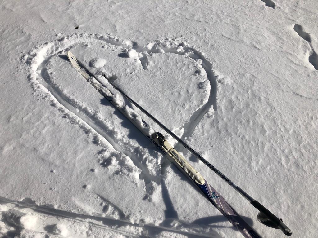
It is widely known that Szklarska Poreba is the center of active leisure. Regardless of the season one can do sports and have fun at the same time. Winter is not only downhill skiing or snowboarding, but also cross-country skiing.
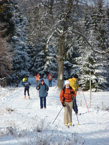
Nordic skiing, is now going through a period of glory and becoming increasingly popular among skiers. Every year more and more people learn cross-country skiing. It does not take a professional sportsperson to freely use the trails and appreciate the sport. Anyone can take up cross-country skiing.
All you have to do is Szklarska Poreba and Jakuszycka Glade on the map of the Jizera Mountains and have some free time. It is a legendary place, where in winter you can successfully train cross-country skiing.
- cross-country skiing trails have a length of about 100 km,
- all of the routes form loops in the shape of clover leaf and join together, giving the possibility to combine the selection of routes, or adapt to your needs,
- part of the route is approved by the FIS
- due to the wonderful climate, the snow cover lasts here with a thick layer until late spring,
- on-site equipment rentals to practice cross-country skiing, and instructors who will help choose the right equipment.
- equipment rentals, shopping, dining and sanitary facilities await cross-country skiers in the Jakuszycka Glade on the main road in Jakuszyce.
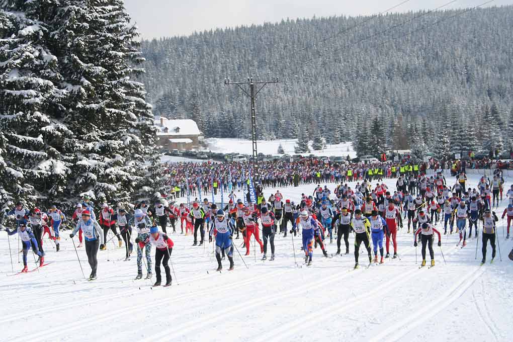
For over 30 years now, Szklarska Poreba has been the host of a great celebration of classic skiing – the Piast Race. From the vary beginning, the event is associated with the figure of Julian Gozdowski - commodore of the race, organizer, president of the Piast Race Association.
In 2010, during the Gala of Sports Champions, Julian Gozdowski received a prestigious award in the category for the Best Mass Event. Since 13 June 2008, the Piast Race is part of the Worldloppet (Worldloppet Ski Federation) - World Endurance Racing League, which now consists of fifteen races around the world.
The amazing atmosphere of the Jizera Mountains is particularly noticeable in the vicinity of the Jakuszycka Glade. The World Cup Champion Justyna Kowalczyk, who took part in this cross-country skiing competition was greatly impressed by the place and by the route: "... it's the only place in Poland to organize future world-class running events. This is a great training base with excellent snow conditions"*.
Both professionals and amateurs train side by side at the cross-country routes in Szklarska Poreba. At the cross-country skiing trails we can also spot, the vice-champion in mountain biking - Maja Włoszczowska.
The fabler route through the "Airplane", a picturesque valley of the Jizera River, the legendary Eagle Village, the hostel at the Mountaineers hut - these are just some of the magical places in the Jizera Mountains.
![]() Map and altitude graphs of running routes. [Adobe Acrobat PDF - 12.39 MB]
Map and altitude graphs of running routes. [Adobe Acrobat PDF - 12.39 MB]
 Map of ski trails in the Biała Dolina i Oś. Huty [JPEG Image - 1.45 MB]
Piast Race Association 58-580 Szklarska Poreba-Jakuszyce
Tel./fax 75 717 33 38, Tel: 75 717 20 22,
e-mail: This email address is being protected from spambots. You need JavaScript enabled to view it.,
www.bieg-piastow.pl
![]() See film
See film
- Details
Ski Arena Szrenica
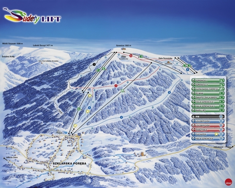
property SUDETY LIFT Sp. z o.o. Szklarska Poręba www.sudetylift.com.pl
- FIS downhill route
very difficult route
length of 2000 m
510 m level difference
average gradient of 25.5%
greatest slope gradient of 50.0% (wall)
the width of Route 30 - 50 m
location of the beginning 1302 m above sea-level route
location of the end of the route 792 m above sea level, where access to the lower K.L. station is available
SZRENICA forest road - 1 km
Installation of artificial snow 80% of the route, from 850 m above sea level to 1225 m above sea-level
- LOLOBRYGIDA Cross country ski run
difficult route
length of 4400 m
602 m level difference
average gradient of 14.0%
greatest slope of 36.0%
width of the route from 1915 to 1945 m
location of the beginning 1310 m above sea-level route
location of the end of the route 708 m above sea-level
installation of artificial snow 88% of the route, from 708 m to 1200 m above sea level
- ŚNIEŻYNKA Cross country ski run
difficult route
length of 2080 m
300 m level difference
average gradient of 15%
greatest slope of 45% ('eses')
width of the route from 1915 to 1935 m
location of the beginning 1182 m above sea-level route
location of the end 882 m above sea-level route
installation of artificial snow 100% of the routes
- POOH Cross country ski run
a simple route
length of 1470 m
level difference of 172 m
average gradient of 12.0%
greatest slope of 27.0%
width of the route from 1915 to 1935 m
location of the beginning of the route 880 m above sea-level
location of the end of the route 708 m above sea-level
installation of artificial snow 100% of the routes
installation of artificial light 100% of the route
- "SZRENICKA ALP" The slope slalom
length of 650 m
120 m level difference
average gradient of 18.5%
greatest slope of 25.5%
width of the slope 100 - 200 m
location of the beginning of the route 1280 m above sea-level
location of the end of the route 1160 m above sea-level
- Details
Mistrz Waloński – Juliusz Naumowicz, realizując wytrwale swoją wizję walońskiej enklawy na szklarskoporębskiej ziemi, zakończył budowę Sali Celtyckiej i Suszarni Karkonoskich Ziół, tym samym Gar Mocy podniósł się o dwa piętra. W jednym miejscu skupione zostały najstarsze i najbardziej tajemnicze karkonoskie tradycje. Walończycy wywodzą się bezpośrednio od Celtów, którzy stworzyli podwaliny europejskiej cywilizacji. Do dziś kultura, sztuka i tajemna wiedza Druidów wzbudzają wielkie emocje. To właśnie wiedzę Celtów wykorzystywali w geologicznej penetracji i górniczej eksploatacji skarbów ziemi Walończycy. Laboranci, przez bez mała 200 lat odkrywali dla Europejczyków kolejny skarb naszych gór – karkonoskie zioła, a sporządzane przez nich mikstury i maści uważano za panaceum na wszelkie dolegliwości, z globusem na czele.
Chyląc głowę przed Mistrzem Walońskim gratulujemy, a na szczególna uwagę zasługuje fakt, że cały obiekt został przystosowany dla osób niepełnosprawnych.
- Details
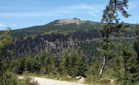
This is the name of the mountain peak overlooking the city, as part of the Central Crest of The Karkonosze Mountains.
- Details
- Details
Szklarska Poreba is located by the National Road 3/E65, connecting north and south of Europe. There are 3 international airports in: Wroclaw, Prague and Dresden in just 2 hours drive.
To get to Szklarska Poreba, you can use the bus and railway communication.
Train timetable
- www.pkp.pl
- Railway Information, phone +48 22 511 6003
- Website of Railways in Szklarska Poreba
Bus timetable
- Bus timetables (station in Jelenia Góra) - www.pks.jgora.pl
- Telephone information PKS Jelenia Gora - Helpline phone: +48 703 403 337
- www.krycha.pl - private bus carrier
Ro-Ko Car Service -timetable
Taxis and buses
- Taxi stop. 1 May St, phone +48 75 717 21 03
- Euro Taxi Jelenia Góra - Szklarska Poreba - Karpacz phone +48 19625 or +48 695 25 25 25
- Halo Taxi 24h, tel. 75 717 30 53, 606 404 135
Transport - useful links:
- www.wroclaw.pl - bus and train connections from Wroclaw
- www.krycha.pl - private bus carrier connections
- www.jizdnirady.cz and timetable.svt.cz - information about communications in the Czech Republic
- www.dbahn.de - reliable, a European information about rail services
- www.airport.wroclaw.pl - Wroclaw Airport
- www.dresden-airport.de - Dresden Airport
- www.pragueairport.co.uk - Prague Airport
- Details
- Details
- Details
BATA
Equestrian Village
19
Wolności
Street
58-580 Szklarska Poręba
Tel.: +48 75 717 32 34
Mobile: +48 603 356 844
E-mail: This email address is being protected from spambots. You need JavaScript enabled to view it.
www.osadabata.pl
We offer carriage rides around Szklarska Poręba.
- Details
- Details
Informacje ogólne
Szklarska Poręba - miasto przepięknie położone w dolinie rzeki Kamiennej z górującą nad miastem Szrenicą (1362 m n. p. m.).
Niewiele jest w Polsce obszarów tak sprzyjających rekreacji, jak okolice Szklarskiej Poręby. Cisza, wciąż zmieniające się krajobrazy, w zależności od oświetlenia czy pory dnia, połączone z szumem krystalicznie czystych potoków i wodospadów, spadających w otoczeniu granitowych skał – to elementy wpływające niezwykle kojąco na naturę ludzką.
Szklarska Poręba jest największą stacją klimatyczną Dolnego Śląska, znaną i cenioną od połowy XIX wieku. Warunki klimatyczne, które tu panują, porównywalne są do walorów miejscowości alpejskich położonych na wysokości powyżej 1200 m n. p. m.
Szklarska Poręba To Kraina Rzepióra – legendarnego Ducha Gór, zwanego Liczyrzepą lub Karkonoszem, który od stuleci strzeże skarbów ukrytych w ziemi i leśnych gęstwinach. Góry, które niegdyś przerażały ludzi swoim ogromem, teraz zachwycają pięknem i zachęcają do poznania swoich tajemnic.
Jeśli dodamy do oferty naszej miejscowości możliwość korzystania z pieszych wędrówek po szlakach turystycznych (piękne, malownicze trasy w obrębie Karkonoskiego Parku Narodowego i Górach Izerskich), z górskiej wspinaczki i niezwykłych tras rowerowych – to będziemy mieli pełną wizję różnorodnych atrakcji, jakie oferuje Szklarska Poręba.
Warto zobaczyć
-
Wodospad Kamieńczyka – woda spada trójstopniową kaskadą z wysokości 27 m do przepięknego Wąwozu Kamieńczyka. więcej
-
Wodospad Szklarki - malowniczo położony na terenie enklawy Karkonoskiego Parku Narodowego, w środkowej części Wąwozu Szklarki. więcej
-
Szrenica – szczyt górujący nad miastem (1362 m n.p.m.) Na wierzchołku znajduje się schronisko „Szrenica”. Mimo, iż Szrenica nie jest górą wysoką, panują tu warunki klimatyczne, takie jak w Alpach na wysokości 2000 m n.p.m. Góra stanowi obszar centrum narciarskiego Skiarena Szrenica. więcej
-
Wysoki Kamień – górujący od zachodu nad Szklarską Porębą szczyt o wysokości 1058 m n.p.m, położony w Wysokim Grzbiecie Gór Izerskich. Ze szczytu rozciąga się przepiękna panorama na okoliczne pasma górskie min. Karkonosze, Rudawy Janowickie oraz Góry i Pogórze Izerskie. Przy dobrej pogodzie widoczność pow. 100 km. więcej
-
Karkonoskie Centrum Edukacji Ekologicznej – przyroda Karkonoskiego Parku Narodowego i Karkonoszy. Ekologia, biologia, działalność człowieka, fauna i flora oraz klimat Karkonoszy zaprezentowane w interaktywny sposób. Centrum przystosowana dla osób niepełnosprawnych. więcej
-
Stara Chata Walońska „JUNA”, ul. Kołłątaja 12, siedziba poszukiwaczy skarbów gór z XV – XX w, udostępniana po telefonicznym uzgodnieniu, możliwość organizacji wycieczek mineralogicznych.
-
Leśna Huta – ul. Kołłątaja 2. Pokaz ręcznej produkcji szkła.
Idziemy na wycieczkę
Ponad 100 km szlaków pieszych w okolicach Szklarskiej Poręby to spora zachęta dla piechurów. Przed wyruszeniem należy zapoznać się z podstawowymi zasadami bezpiecznego zachowania się w górach oraz zaopatrzyć w odpowiednie mapy i przewodniki.
Grupy zorganizowane nie powinny wybierać się w góry bez fachowej opieki przewodnika sudeckiego.
Idąc w góry pamiętaj:
- Przed wyjściem w góry zasięgnij informacji o terenie w który się udajesz, zapoznaj się z mapą
- W miejscu swojego zamieszkania lub ostatniego pobytu zostaw wiadomość gdzie idziesz, którędy i kiedy masz zamiar wrócić
- Dobierz sobie odpowiedniego towarzysza – w żadnym wypadku nie udawaj się w góry samotnie
- W miejscu swojego zamieszkania lub ostatniego pobytu zostaw wiadomość gdzie idziesz, którędy i kiedy masz zamiar wrócić
- W góry wychodź wcześnie rano, abyś zdążył do celu przed zmrokiem, ubierz się odpowiednio do pory roku i weź ze sobą nieprzemakalne okrycie i zapasową odzież
- W miejscu swojego zamieszkania lub ostatniego pobytu zostaw wiadomość gdzie idziesz, którędy i kiedy masz zamiar wrócić
- Nie schodź nigdy ze znakowanego szlaku turystycznego, pod żadnym pozorem nie skracaj sobie w ten sposób drogi. Nie niszcz oznakowań na szlaku. Gdy zbłądziłeś, cofnij się drogą, którą dotychczas podążałeś.
- W miejscu swojego zamieszkania lub ostatniego pobytu zostaw wiadomość gdzie idziesz, którędy i kiedy masz zamiar wrócić
- Organizując wycieczkę z biurem podróży lub szkolną, zadbaj aby prowadził ją kwalifikowany przewodnik górski, on gwarantuje Wasze bezpieczeństwo. Idąc na wycieczkę rodzinną dbaj o swoje dzieci aby się nie pogubiły.
- W miejscu swojego zamieszkania lub ostatniego pobytu zostaw wiadomość gdzie idziesz, którędy i kiedy masz zamiar wrócić
- Skompletuj małą apteczkę, która nie zabierze ci dużo miejsca w plecaku, a zawsze będzie pod ręką.
- W miejscu swojego zamieszkania lub ostatniego pobytu zostaw wiadomość gdzie idziesz, którędy i kiedy masz zamiar wrócić
- Dla własnego dobra i bezpieczeństwa korzystaj z informacji, które możesz zawsze uzyskać w stacji centralnej GOPR – przyjdź lub zadzwoń
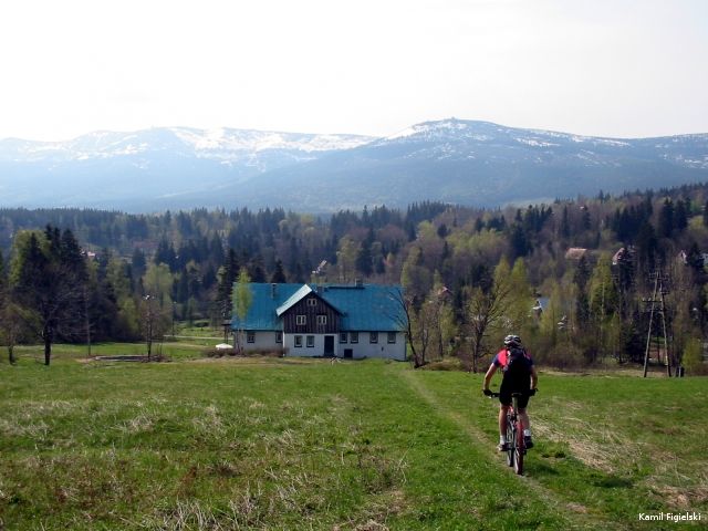
Szklarska Poręba – rowerowa kraina
Nikogo, kto zasmakował górskiej turystyki rowerowej, nie trzeba przekonywać o atutach tej formy aktywnego wypoczynku. Przemierzanie górskich szlaków na dwóch kółkach daje możliwość pokonywania większych dystansów niż turystyka piesza, niesie ze sobą poczucie przestrzeni i niezależności, niejednokrotnie podnosi poziom adrenaliny oraz przysparza wiele pozytywnych emocji. Zatrzymując się w Szklarskiej Porębie na dłużej nie zaznasz nudy. Szeroki wybór propozycji stwarza możliwość zwiedzania okolic każdego dnia inną trasą.
Miasto jest doskonałym punktem wypadowym wycieczek szosowych w głąb polskich i czeskich Karkonoszy i Gór Izerskich oraz do atrakcyjnych, turystycznych miejscowości po jednej i drugiej stronie granicy. Trasy rowerowe Szklarskiej Poręby łączą się z trasami rowerowymi okolic Harrachova (CZ) przez turystyczne-górskie przejścia graniczne.
Przez Szklarską Porębę przebiega Euroregionalny długodystansowy szlak rowerowy „Liczyrzepa” ER-2 biegnący przez całe Sudety – z Zittau do Mieroszowa.
Więcej o trasach: www.rowerowakraina.com
Nawet najbardziej wybrednych rowerzystów zadowoli:
- 19 tras rowerowych
- Łączna długość tras: 450 km
- Trasy o długości od 8 do 50 km
- Kontakt z naturą
U nas znajdziesz:
- W Górach Izerskich trasy łatwe, małe przewyższenia, wspaniałe panoramy, wielkie przestrzenie
- W Karkonoszach – trasy wymagające dla zaawansowanych, a przy tym zapierające dech w piersiach krajobrazy
- Kontakt z naturą – 80% tras przebiega drogami leśnymi, szutrowymi i kamienistymi lub górskimi ścieżkami w bezpośrednim sąsiedztwie Karkonoskiego Parku Narodowego
- Możliwość całodziennych wypraw rowerowych na trasie, których czekają gościnne schroniska z górskim jadłem
- „Kwatera dla rowera” – czyli noclegi w obiektach z zamykanym rowerowym parkingiem
- Wypożyczalnie rowerów, punkty serwisowe i sklepy ze sprzętem i akcesoriami rowerowymi
- Największy w Europie Środkowej Festiwal Rowerowy BIKE ACTION – marathon, downhill cup, dirt jump, trial show
- Details
Góry kojarzone są głównie z narciarstwem. Nic bardziej mylnego. Z każdym rokiem rośnie liczba sprzedanych usług w sezonie letnim. Turyści sami dostrzegli, że w górach nawet przy pochmurnej pogodzie, jest więcej atrakcji niż nad morzem czy jeziorami.
Nasze miasto oferuje gościom setki kilometrów tras pieszych i rowerowych o różnym stopniu trudności. Dziesiątki przyrodniczych i historycznych atrakcji. Przyroda Karkonoskiego Parku Narodowego zachwyca przez cały rok. Góry Izerskie oferują ciszę i spokój.
Szklarska Poręba często nazywana mineralogiczną stolicą Polski, nie tylko za sprawą dwóch muzeów i kilku sklepów, lecz możliwości znalezienia pięknych kryształów górskich, ametystów i innych.
U nas trudno się nudzić.
- Details
Szklarska Poręba to doskonały punkt wypadowy do zwiedzania całych Sudetów Zachodnich. W promieniu 30 km znajdują się takie miasta i atrakcje jak:
- Harrachov (8 km) – skocznie narciarskie, mini browar
- Karpacz (26 km), - Śnieżka ( 1603 m. n.p.m.), Muzeum Zabawek, Muzeum Sportu i Turystyki, Kościółek Wang;
- Kowary (25 km) – Trasa wycieczkowa – Sztolnie Kowarskie
- Ścięgny (23 km) – Western City
- Jelenia Góra – Sobieszów ( 12 km), ruiny zamku Chojnik, Muzeum Karkonoskiego Parku Narodowego;
- Jelenia Góra – Cieplice (15 km), Muzeum Przyrodnicze, Uzdrowisko i Park Zdrojowy;
- Jelenia Góra ( 22 km ), Muzeum Karkonoskie i Starówka.
- Dolina Zamków i Ogrodów ( około 23 km)
- Świeradów Zdrój ( 20 km) - Park Zdrojowy
- Frydralnd (30 km)- średniowieczny zamek
- Zittau (50 km) - starówka
Więcej o regionie na stronie www.karkonosz.pl
- Details
Bardzo dogodne położenie naszego miasta, do którego prowadzi droga krajowa łącząca północ z południem Europy, a także połączenie kolejowe i przede wszystkim bardzo duża turystyczna atrakcyjność, powodują, że rocznie odwiedza nas około miliona turystów.
Kolejne inwestycje sportowo-rekreacyjne, a także moda na „zdrowy i aktywny” tryb życia spowodują, że nasze miasto będzie odwiedzać coraz więcej gości. Nie bez znaczenia są światowe tendencje wskazujące na dalszy, dynamiczny rozwój turystyki, zarówno w sektorze krajowym jak i zagranicznym.
- szlaki piesze - ponad 100 km
- szlaki rowerowe - łączna długość tras 450 km, trasy o długości od 8 do 50 km
- nartostrady i stoki – 15 km
- wyciągi - 11
- trasy biegowe - łączna długość ponad 100 km
- miejsc noclegowych około 10 tysięcy
- Karkonoski Park Narodowy
- Rezerwat Przyrody - Torfowiska Izerskie
- muzea i galerie – 11 szt.
- liczne atrakcje: Stara Chata Walońska, Leśna Huta, wodospady…

